
Measure millimeter-level ground motion from space.
LOOKNorth’s Ground Deformation Service is used to monitor millimeter-level ground movement in and around infrastructure in place and under construction.
This service helps operators and construction contractors identify and assess risk to oil field operations, pipelines, roads and highways, bridges, hydro dams, airports and tunnelling projects.
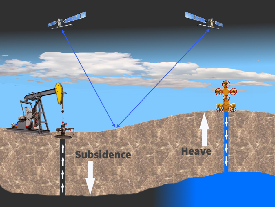
Using phase difference measurements from satellite radar sensors, we can detect millimeter-level ground motion. This information can be used to proactively determine strains on pipelines traversing areas where oil is being extracted (causing subsidence) or where water is being injected (causing heave).
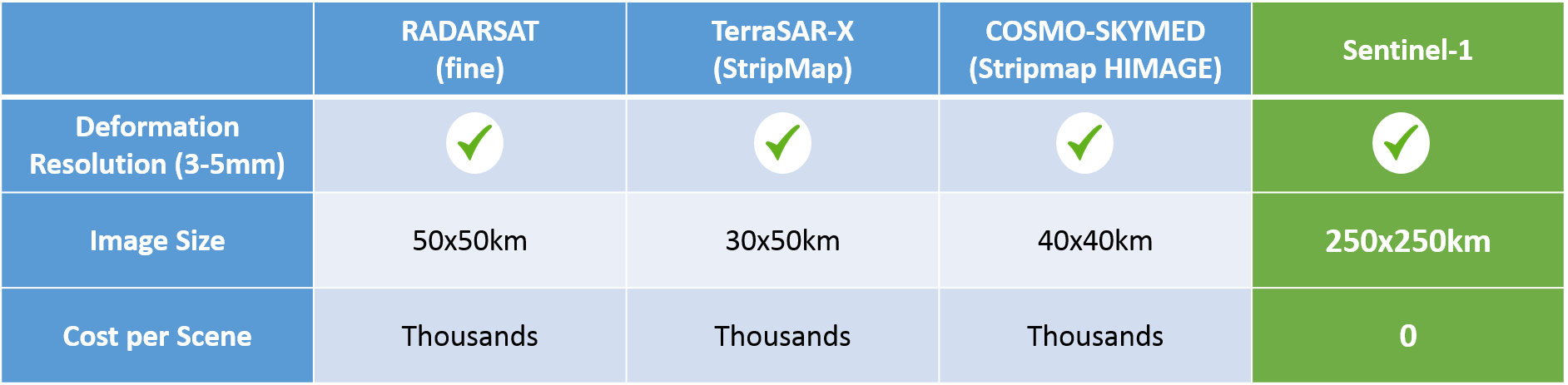
LOOKNorth chooses the most appropriate and cost-effective source of data for your needs. One of our key deformation services uses free imagery from the European Space Agency's Sentinel-1 satellite mission, providing extremely cost-effective insights for infrastructure operators.

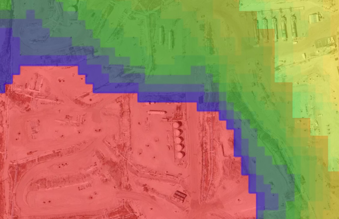
Using our simple interface, you can click on any location we are monitoring to quickly see how your infrastructure or the ground around it may have moved. Our basic service provides up to 30 measurements per year.
Our easy-to-use web interface immediately highlights areas of movement in or around your asset. The information is stored in our secure cloud-based database and is also available in standards-based data formats for ingestion into customer-owned GIS Systems.
