Current and historical maps of water quality as observed from optical satellite sensors.
LOOKNorth’s water monitoring service uses satellite imagery to measure temperature, chlorophyll, sediment levels and other parameters within rivers and lakes. Near real-time data combined with historical data provides a cost-effective means to track the health and changes in inland water systems.
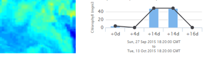
Many rivers are hundreds of kilometers long. Using our web interface, analysts can quickly zoom and pan through satellite imagery to get a detailed view of any section of a monitored river to investigate known trouble spots. Detecting events that affect water quality, such as algae blooms or human-made pollution, provides insight into the overall health of inland water systems.
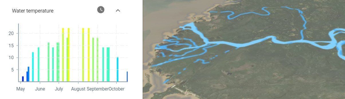
With access to seasonal data along the entire river, hydrologists can quickly and easily track the emergence of open water to help predict river break up, assess flood risk and provide proactive emergency measures for cities, businesses, and communities. Temperature levels during summer can also be used as an indicator of wildlife habitat health.
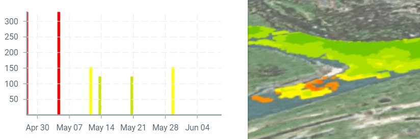
Water sediment levels have been used by researchers as a indicator of wildlife population and habitat health, but can also be used by pipeline operators to predict the amount of river bank scour at pipeline crossing locations.
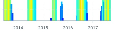
The water quality service stores multi-year historical data to allows users of the data to visualize trends that can be used to as input for water quality forecasting models.