Monitor or validate the reclamation of land from abandoned well sites, mines or infrastructure projects.
LOOKNorth’s Land Reclamation Service uses satellite imagery to measure the progress of land reclamation activities for oil field well sites, mines and infrastructure projects. This service is used by both operators and environmental regulators to quantify the level of reclamation. For industry, this is an invaluable tool to provide evidence of regulatory compliance. For regulators, it provides a means to track and rate progress.
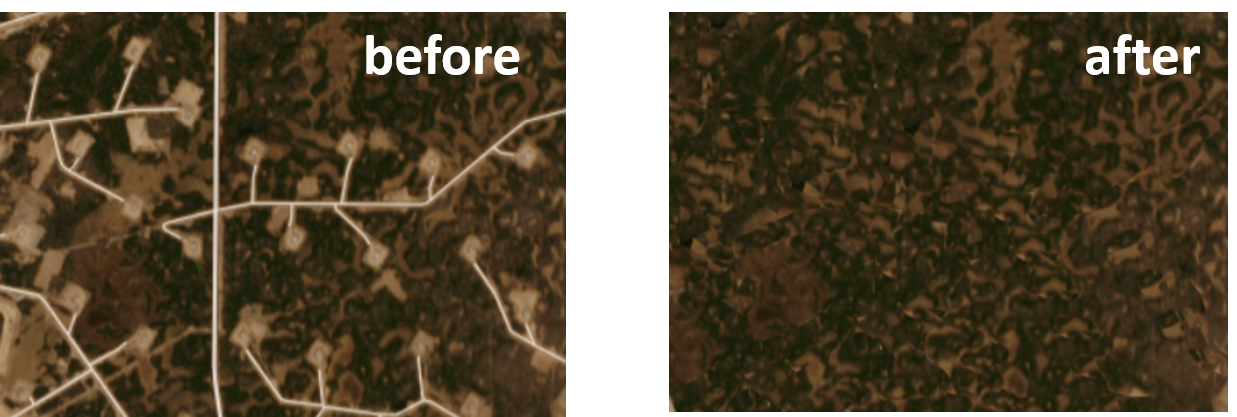
Reclamation is a critical and expensive component of any commercial project where industry interacts with the environment.
Satellite-based reclamation monitoring offers a cost-effective means for operators and regulators to track the progress of reclamation activities.
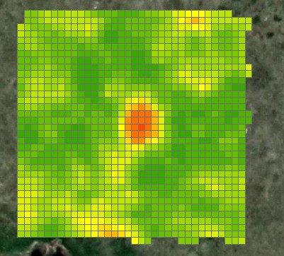
Reclamation progress is derived from optical satellite data which is analyzed, classified and displayed through an easy-to-use web interface.
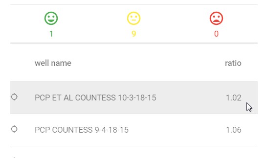
Users can quickly determine the status and rate of progress of reclamation at a particular location.
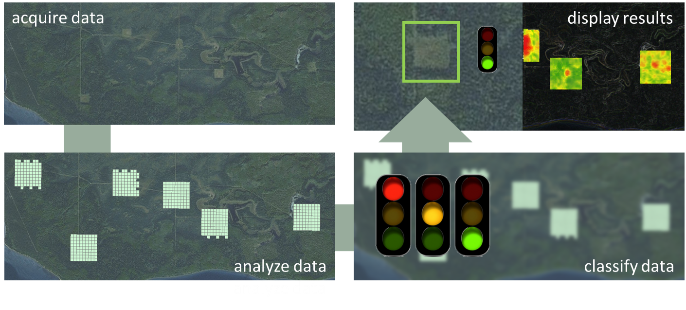
The reclamation service provides evidence to support compliance with reclamation criteria, as well as a historical record of compliance for an operator to support future audit requirements.
Once a well site or section of mine has been classified, the service ranks the status of reclamation. This ranking provides a quantitative means to identify reclamation areas that are in good standing and ready for certification or, alternately, to identify areas where extra work is required to progress reclamation activities towards a positive conclusion.